

NOCO Trail: Redline and Alternate Updates
Segment 1 - Hourglass Trail - Comanche Peak Wilderness
Segment 1 Redline Reroute & Alternate Route Updates
The original route I planned when working on this project linked a series of trails over Comanche Peak, but due to its lack of congruency with the overall route, I decided to use the lower Mummy Pass Trail as the Redline Route. The Comanche Peaks High Route alternate was published for those who didn’t mind going a little out of the way for the chance to experience the views from Comanche Peak. Thanks to hikers who provided valuable feedback on a section of this alternate, I discovered it required fording the Cache la Poudre River, which poses a challenge to anyone looking to ford it and may be dangerous to attempt in the early season. Due to this, I have removed the Comanche Peak High Route alternate.
The entire region around the Mummy Pass Trail (original Redline Route) saw massive destruction in 2020 from the Cameron Peak Fire, the largest fire in Colorado history. The Upper Mummy Pass Trail is nearly non-existent and is more of a route than a trail, not making it an optimal route through the area. After receiving similar feedback from hikers this season and having discussed the issue with Rocky Mountain National Park’s Wilderness Office, I have decided to remove the Upper Mummy Pass Trail as the Redline Route through the area.
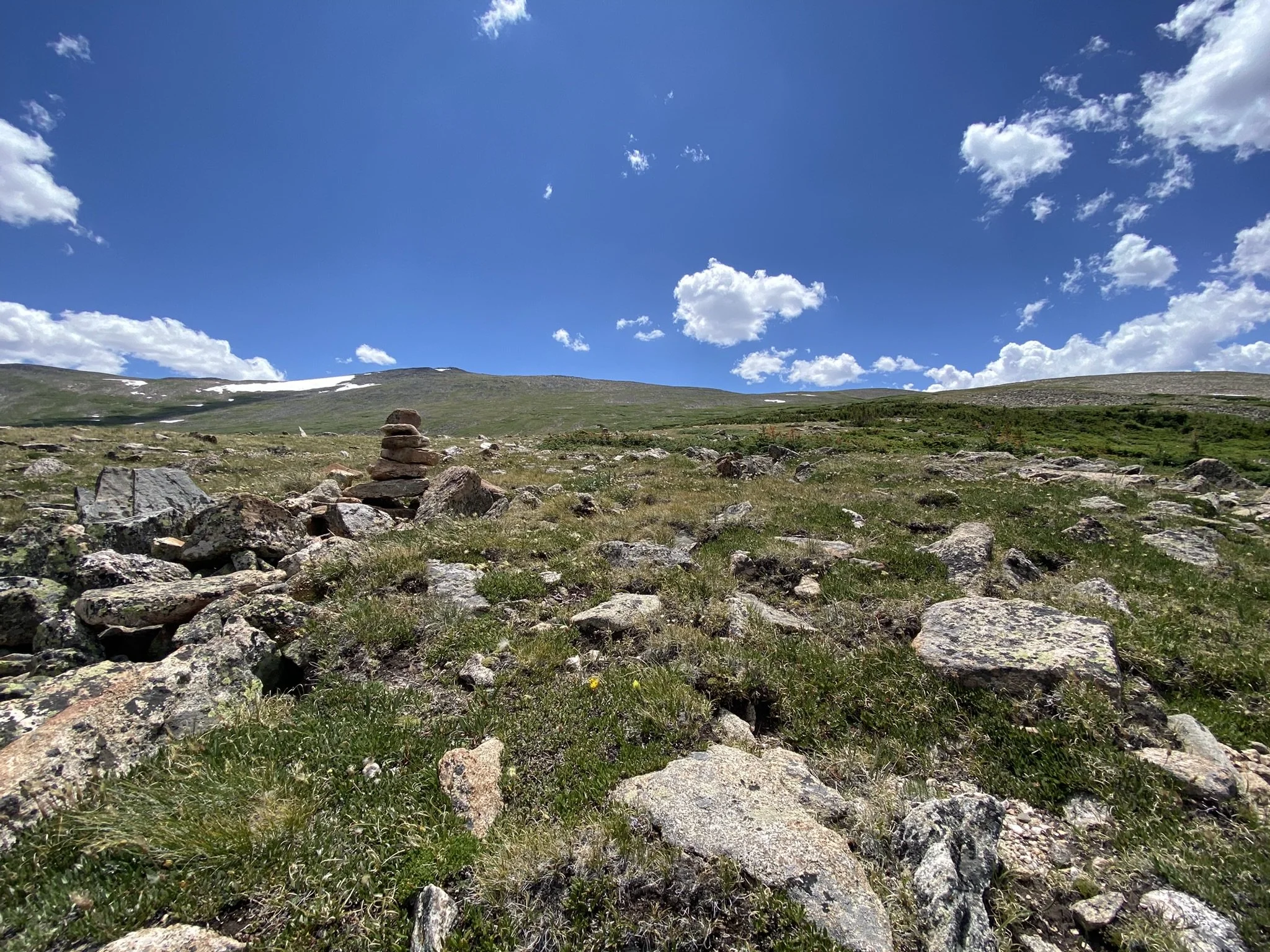
Having spent several weeks looking at possible alternatives both on paper and in the field, I believe there is an optimal route which travels over Comanche Peak, climbing over 12,500 feet in elevation. This reroute uses Forest Service Road 145, Bear Creek Trail, Hourglass Trail, Comanche Peak Trail, and Mirror Lake Trail before connecting to the Lower Mummy Pass Trail in Rocky Mountain National Park. Trail Guides, Maps, GPS Routes and GPS Waypoints have been updated to reflect this route change. This reroute is 4.4 miles longer, has 1,600 more feet of elevation gain and 1,500 more feet of elevation loss.
Though the Upper Mummy Pass Trail is in dire need of maintenance, the area around Mummy Pass is beautiful and provides a lower route option for those not interested in going over the high country. With this in mind, the Mummy Pass Alternate has been added, and it follows the previous Redline Route. This alternate requires route finding and spends significant time above treeline, not making it “safe” to use in stormy weather. Proper planning is required for any route chosen in this area.
The Rocky Mountain National Park Bypass still requires fording the Cache la Poudre River, which runs very high in the early season. The bridge, which use to reside at this crossing, was washed out many years ago. A rebuilding of this bridge would be a great project for the Northern Colorado Trail Community to support in the future. With dogs not being allowed in the national park, this bridge would provide a safe path for those looking to hike the route with their furry companion as well as provide a much lower alternate route through the area.
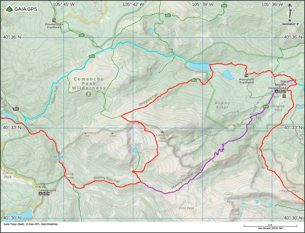
Map of changes to Segment 1 Redline Route - RMNP Bypass (Cyan) - Added Mummy Pass Alternate (Purple) (Previous Redline Route)
Segment 4 New Alternate Route - White River Bypass
In the southern region of Segment 4, the Northern Colorado Trail route requires fording the White River. Most of the season, this is a simple task requiring basic knowledge about river crossing. The White River is shallow enough in places to enjoy a refreshing swim and often has people fishing while wading in the river. That being said, the river does run higher in the early season before the snow has fully melted, and during high snow years this may continue later into the hiking season.
With this in mind, the White River Bypass has been added (Trail Guides, Maps, GPS Route, GPS Waypoints) which avoids this river ford while still providing incredible scenery. This alternate is 6.9 miles shorter than the Redline Route and bypasses scenic points such as Wall Lake, Lost Solar Park, and the Nichols Creek Trail, which offers grand views during the descent to the White River.

Segment 4 - White River Bypass (Blue)
With the hiking season well underway and more hikers finding their way to the trails along the route, more route updates could happen, but are not expected. Check the Trail Alerts/Updates page for the most up to date information.
Within the next week, a route completion page will be added for anyone who feels they have completed all of the segments of the Northern Colorado Trail.