

Trail Maps
Click on map set links to download PDF versions of the Trail Maps.
Map Sets with Multiple Maps will download in .zip format and will need to be decompressed.
Each segment has an associated Trail Guides, GPS Routes & GPS Waypoints.
Click on interactive maps to explore each segment.
All files published on www.northerncoloradotrail.org are for personal use only and may not be resold, redistributed, or used for commercial purposes without prior written consent. By accessing these resources, users agree to the terms of use, which govern the use of this website and its content.

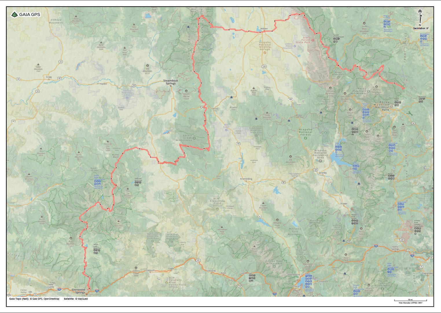
UPDATED 7-31-2025 Interactive Map - All Routes - Click on Image (may take several seconds to load)
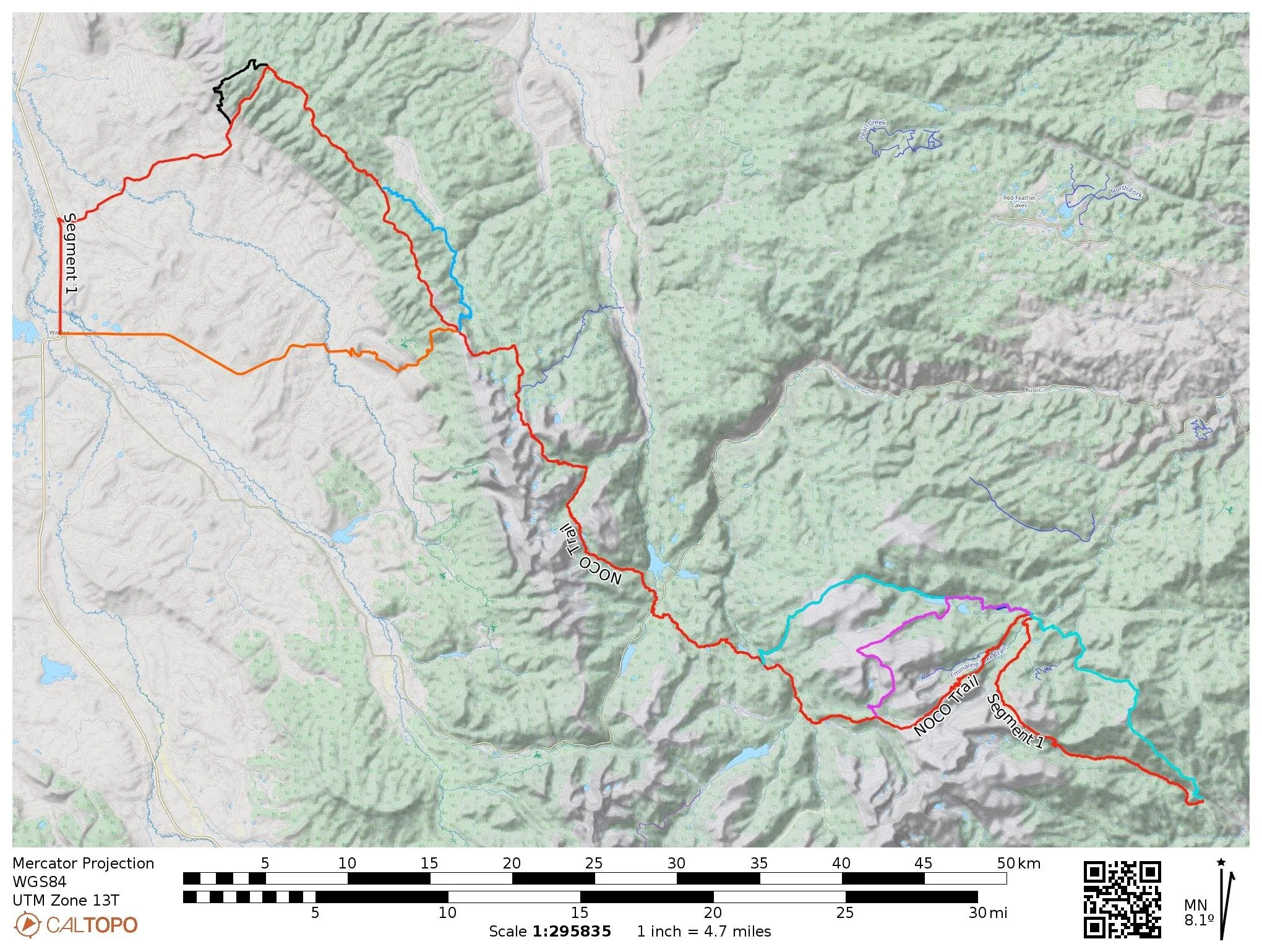
Segment 1: Dunraven TH to Walden
Updated 7-20-2025
NOCO Trail Segment 1 Redline Maps (1-14)
NOCO Trail Segment 1 Redline Maps (15-28)
NOCO Trail Segment 1 Redline Maps (29-35)
Alternate Routes
Rocky Mountain National Park Bypass (Cyan) (12)
Mummy Pass Alternate (Purple) (4)
Segment 2: Walden to Hwy 40 (Steamboat Springs)
Updated 3-7-2025
NOCO Trail Segment 2 Redline Maps (1-16)
NOCO Trail Segment 2 Redline Maps (17-31)
Steamboat Springs Town Maps (2)
Alternate Routes
Lone Pine Alternate (Orange) (3)
Lost Ranger Alternate (Purple) (4)
Rainbow Lake Alternate (Pink) (8)
Steamboat Springs Via Fish Creek Trail (No-hitch resupply) (4)
Segment 3: Hwy 40 to Yampa
Updated 3-7-2025
NOCO Trail Segment 3 Redline Maps (1-14)
NOCO Trail Segment 3 Redline Maps (15-27)
Alternate Routes
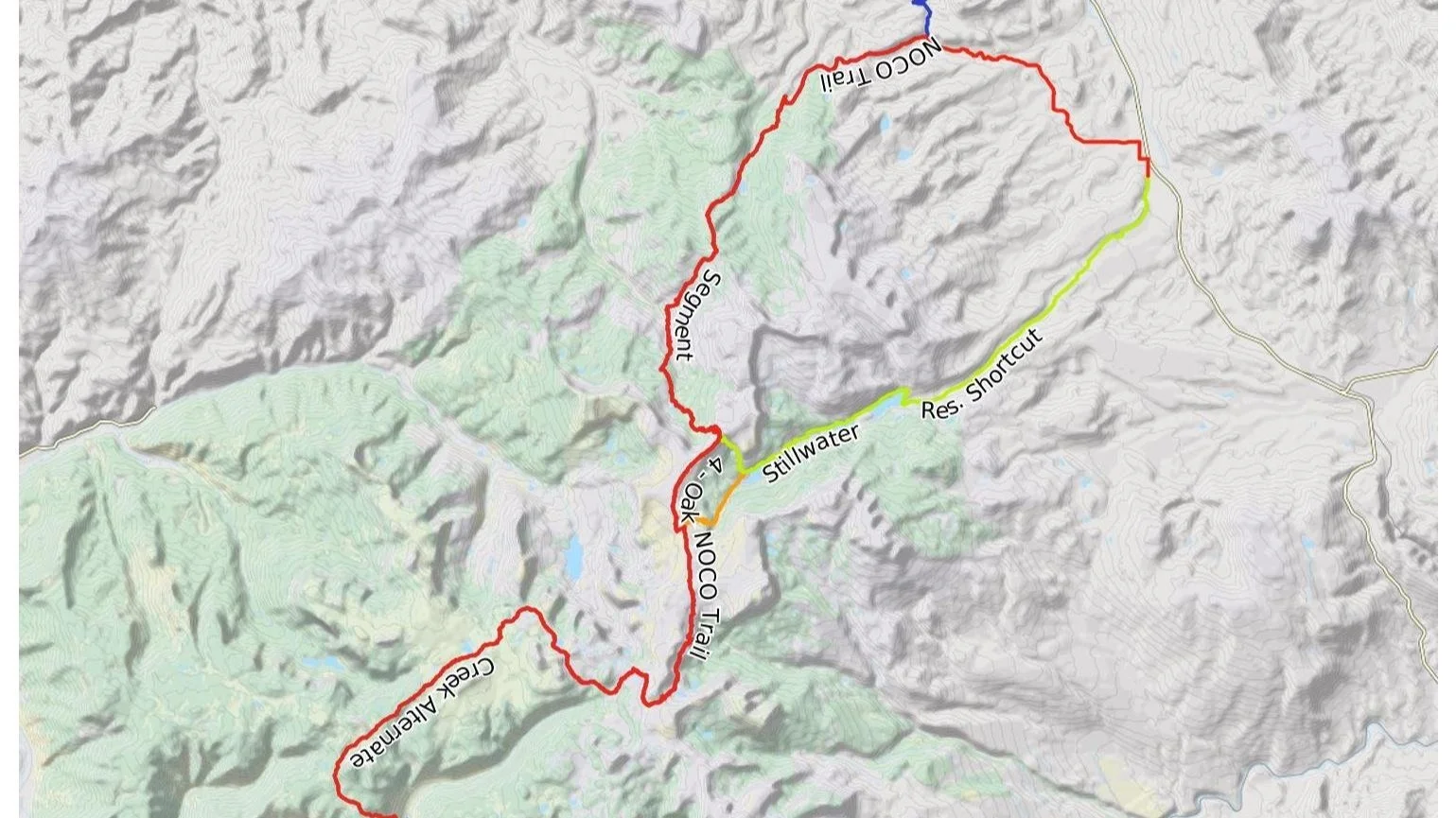
Segment 4: Yampa to Glenwood Springs
Updated 7-20-2025
NOCO Trail Segment 4 Redline Maps (1-24)
NOCO Trail Segment 4 Redline Maps (25-43)
Alternate Routes
Oak Creek to Glenwood Springs Alternate (4)
Stillwater Shortcut (Green) (6)
No-Name/Jess Weaver Alternate (Coming Soon)
Interactive Map - Segment 1 - UPDATED 7-31-2025

Interactive Map - Segment 2 - UPDATED 4-13-2025

Interactive Map - Segment 3 - UPDATED 4-13-2025
Interactive Map - Segment 4 - UPDATED 7-31-2025